S15 Senderos Gran Canaria
Cruz de Tejeda - San Isidro - Teror

This itinerary begins in the town of Vega de San Mateo, concretely in Cruz de Tejeda. This site is a crossroads of roads and ways, divides of the townships of San Mateo and Tejeda, and is an obligatory stop to see their wonderful landscape. Is accessible by public transport, and there are an Insular Office of Tourism.
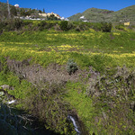
Precisely, right behind that office begins the road that descends from the slopes of San Mateo towards Las Lagunetas. After crossing at various points of the main road (GC-15) leads us to the ravine bed of La Mina, in the neighbourhood of La Solana, and held in this side of the basin to ascend to the village of Aríñez.
It is divided into the following sections:
Section 1: Cruz de Tejeda-La Solana (in front of Las Lagunetas)
Distance: about 2500 metres. Approximate time: 35 minutes
Section 2: La Solana-Cañada de Los Sauces-Lomo Aríñez
Distance: about 2800 metres. Approximate time: 1 hour
Section 3: Iglesia de Aríñez-Cruz del Herrero-Presa de Aríñez-Lomo Candelaria
Distance: about 2700 metres. Approximate time: 1 hour
Path in Teror
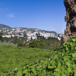
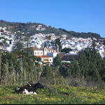
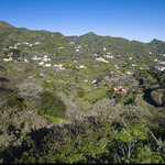
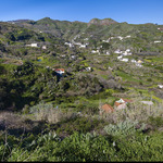
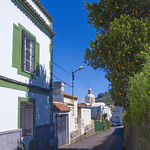
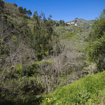
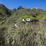
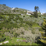
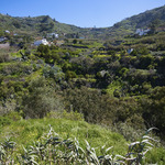
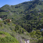
Already in the township of the Villa Mariana de Teror, the path runs through a fertile green and rich in potatoes and maize field. It is a foggy place, continually washed by the trade winds. It also has a set of beautiful white houses scattered throughout the basin, whose epicentre is the beautiful and slender Sacred Heart (Sagrado Corazón-Los Arbejales). All around, small neighbourhoods like El Ojero, Lomontero, Llano de Roque, El Sequero, San Isidro, La Majadilla, etc.
The Portuguese were the first inhabitants of this valley (XV century), which was covered with a forest of laurel, called Selva de Doramas. Viera y Clavijo checked 29 water springs in the area, but the need for soil to farm the land pushed back the forest.
Section 1: Pista del Gallego-Los Sequeros-Casa Matos-Sagrado Corazón.
Distance: about 1800 metres. Approximate time: 45 minutes.
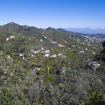
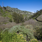
On the hill of Candelaria (fork Teror-San Mateo-Aríñez, GC-42 and GC-400 road, there is a small bar-restaurant) we can view from both sides, the dividing line between the towns of Teror and San Mateo. On your left and in the horizon you can see the highest mountain in Teror, Montaña de Manuel, eucalyptus, and Montaña Valerio. In the background you can see the mountain of Gallego.
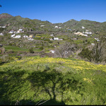
We leave the asphalt and walk towards the mountain Gallego, with a cross on top. Take the track on the left and we see a group of Aeonium undulatum, growing between the rocks and the morgallana (Ranunculus cortusifolius), with its bright yellow flowers.
We descend a few feet, and another track on the left lets us see several chestnut trees and reach a flat area, where we take a road around to the right behind a house with red tile n. 15. We follow the water pipe, then take the next fork to the right, always following the pipe. We passed a walnut tree, and a stone wall and several groups of laurels appear (species reminiscent of the ancient laurel forests that populated these mountains).
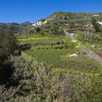
We continue down the shade of a chestnut tree until reaching another road where we turn right. We arrive to a great eucalyptus at end of the road, in front of some houses. We have gone through a trial separating farms, in a predominantly agricultural setting. Care must be taken to avoid treading on the crops.
The route finalises in "Los Sequeros" as the sign indicates. We come to a concrete runway and then take the asphalt,
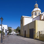
Road to the right, surrounded by poplars, we ascend to600 meters, Casa Matos, Llano del Roque and the town centre of Sagrado Corazón, which you access by Juan Montesdeoca Rivero street, which is at the back of the church.
Section 2: Sagrado Corazón-El Álamo.
Distance: 2.300 metres. Approximate time: 35 minutes.
Itinerary. Take the asphalt on a small road called "Camino vecinal Arbejales - La Molineta. which
begins in facade of the Church of the Sagrado Corazón, and down sharply along the ravine Barbuzano (on your left) looking to the Ojero ravine, then onto the section named "Camino Real del Alamo" and the sports facilities the Alamo square and Equality.
You have to pay attention when the road crosses the ravine on a bridge. We must take first left and then crossing it, and then right.
Section 3: section 3 El Álamo to the centre el centro of Teror.
Distance: 1.400 metres. Approximate time: 25 minutes.
In this moment, we have to descend to the street "Pintora y Escultora Pino Falcon" till the next junction, where you have to take a left hand by the La Ligüeña walk, and then by the Walk of Florian. In this stretch, we will find a Bridge to cross over the ravine of Teror and then go on until the town center by "El Chorrito" street.